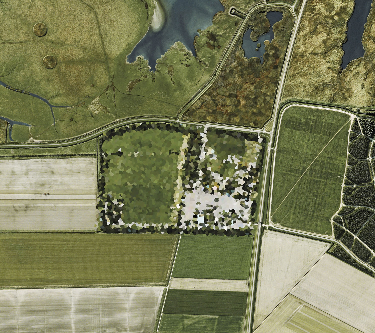
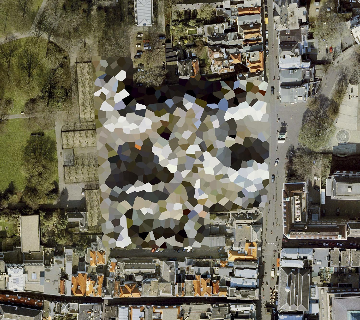
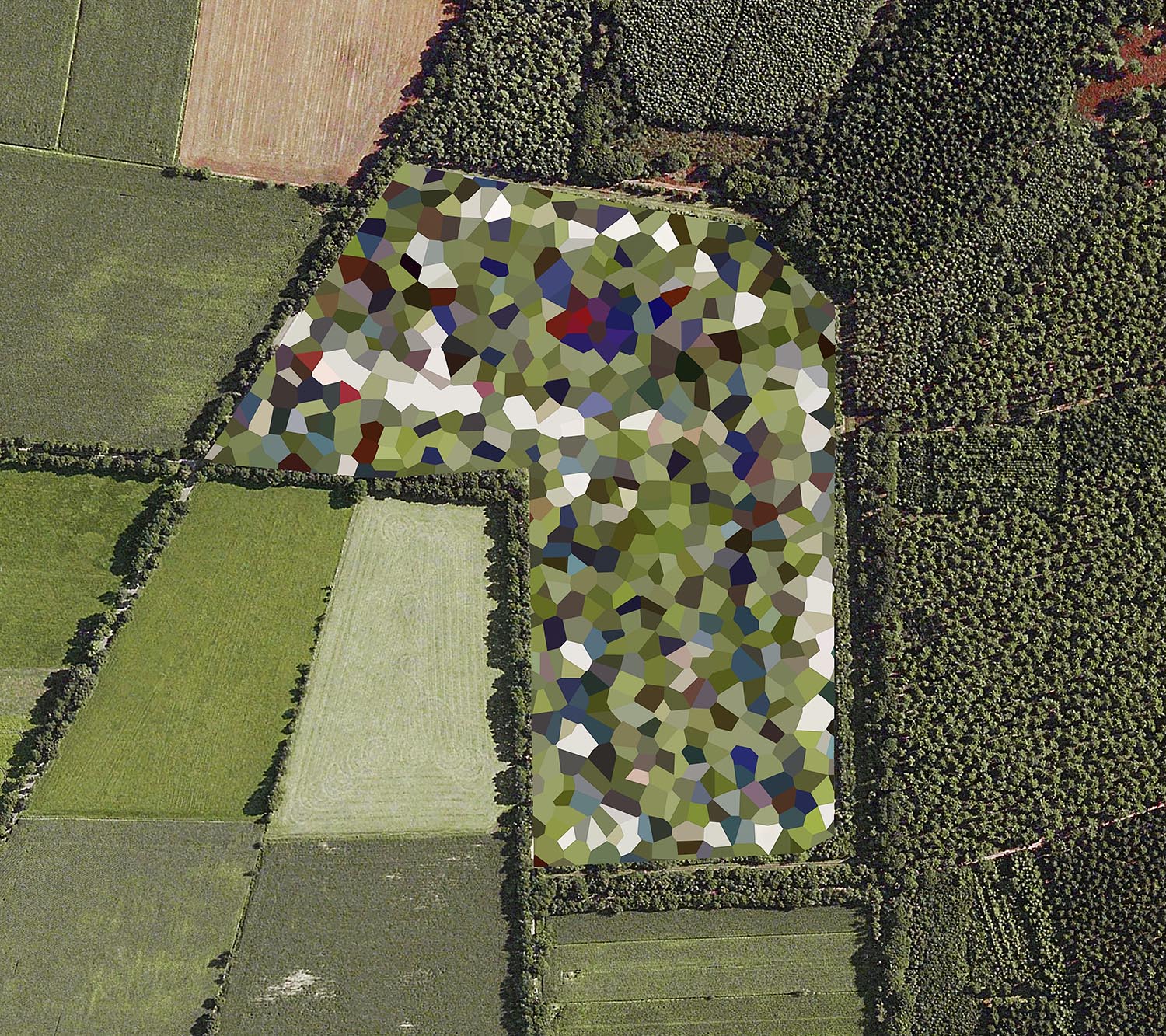
When Google Earth launched in 2005, governments were quick to censor sites deemed vital to national security. In the Netherlands, this censorship took the form of bold geometric polygons laid over military and political sites. Seen from above, the country became a strange new landscape, where secrecy itself turned into an act of abstraction.
Google’s free satellite imagery promised unprecedented transparency, but governments soon demanded the obscuring of sensitive sites. Whereas most countries relied on blurring, pixelation, or cloning to hide military bases, palaces, and fuel depots, the Dutch authorities imposed bold, multicoloured polygons — a unique aesthetic intervention in the landscape. Hundreds of sites were covered in this way, from royal palaces to NATO facilities, transforming familiar fields and towns into collages of colour.
This collision of analogue and digital forms echoes the Netherlands’ long history of engineering its terrain. Just as dykes, polders, and drainage networks reshaped the land to hold back the sea, these censor blocks reshaped the land to guard against a perceived human threat. From orbit, the result is a surreal paradox: a country made more visible precisely by the act of concealment.
This collision of analogue and digital forms echoes the Netherlands’ long history of engineering its terrain. Just as dykes, polders, and drainage networks reshaped the land to hold back the sea, these censor blocks reshaped the land to guard against a perceived human threat. From orbit, the result is a surreal paradox: a country made more visible precisely by the act of concealment.


List of works, medium and dimensions
Softcover print-on-demand book. 10×8 inches (25×20 cm), 106 pages.
Artillery Schiet Kamp, 't Harde, Gelderland (2011)
Archival pigment print, 80x90cm / 150x168cm
De Peel Patriot Missle Site, Limburg,Gelderland (2011)
Archival pigment print, 80x90cm / 150x168cm
Frederikkazerne, The Hague, South Holland (2011)
Archival pigment print, 80x90cm / 150x168cm
Mauritskazerne, Ede, Gelderland (2011)
Archival pigment print, 80x90cm / 150x168cm
NATO Storage Annex, Coevorden, Drenthe (2011)
Archival pigment print, 80x90cm / 150x168cm
Navigatiestation, Den Helder, North Holland (2011)
Archival pigment print, 80x90cm / 150x168cm
Noordeinde Palace, The Hague, South Holland (2011)
Archival pigment print, 80x90cm / 150x168cm
Prins Maurits Army Barracks, Ede, Gelderland (2011)
Archival pigment print, 80x90cm / 150x168cm
St Haagsche Schoolvereeniging, The Hague, South Holland (2011)
Archival pigment print, 80x90cm / 150x168cm
Staphorst Ammunition Depot, Overijssel (2011)
Archival pigment print, 80x90cm / 150x168cm
Unknown Site, Noordwijk aan Zee, South Holland (2011)
Archival pigment print, 80x90cm / 150x168cm
Willem Lodewijk van Nassau Kazerne, Vierhuizen, Groningen (2011)
Archival pigment print, 80x90cm / 150x168cm
SELECTED PRESS


SELECTED EXHIBITION HISTORY

RELATED PROJECTS
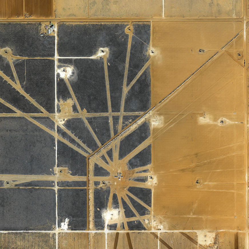
FIELDS
![]()
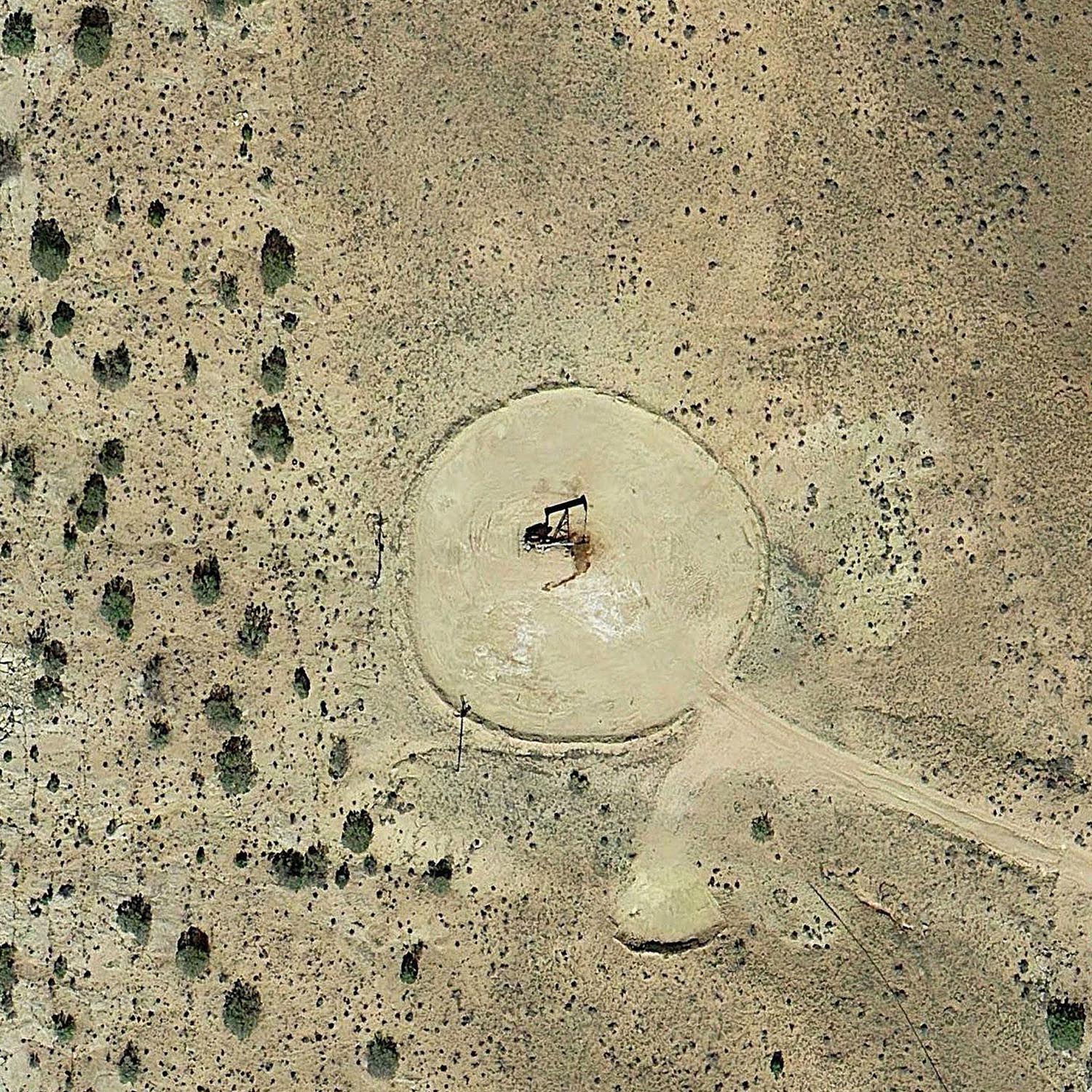
EIGHTEEN PUMPJACKS
![]()
EVAPORATION PONDS